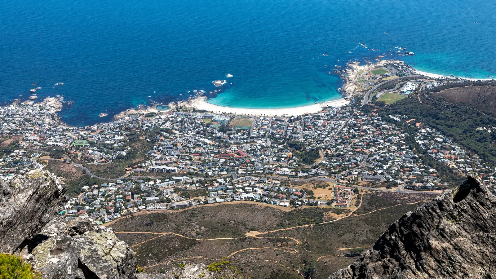
Cape Town and Table Mountain: A City Beneath a Flat-Topped Giant
Few cities are defined by a single landform the way Cape Town is by Table Mountain. Here is how the mountain shapes the city, when to climb it, and how to read the famous cloud that spills over its edge.
Cape Town sits in a natural amphitheatre between the Atlantic and a wall of sandstone mountains, and the centrepiece is Table Mountain — a flat-topped massif rising to 1,086 metres directly above the city. The mountain is not a backdrop; it is the city's organising principle, dividing neighbourhoods, channelling weather, and giving Cape Town its instantly recognisable skyline.
For a traveller, the practical headline is the wind. Table Mountain is reached by a rotating cable car or on foot, but the cable car closes in high wind, and Cape Town's south-easter — the strong summer wind locals call the Cape Doctor — can shut it without warning. The advice is simple: go up on the first clear, calm morning you get, rather than saving it for a fixed day. The mountain rewards flexibility.
A mountain older than almost anything around it
Table Mountain is built largely of hard quartzitic sandstone, laid down as sediment many hundreds of millions of years ago and later uplifted and eroded into the flat plateau seen today. That sandstone is tough and resistant, which is why the summit is so level — softer rock around it wore away while the cap endured.
The mountain anchors a longer chain that runs down the Cape Peninsula, including the peaks of Devil's Peak and Lion's Head on either side of the city. Together they form Table Mountain National Park, which protects not only the rock but an extraordinarily rich plant community found on its slopes.
The tablecloth: reading the cloud
On many days a smooth sheet of cloud forms over the summit and pours down the northern face like fabric over the edge of a table — the phenomenon Capetonians call the tablecloth. It happens when the moist south-easter is forced up the mountain's southern side; the air cools and condenses into cloud as it rises, then evaporates again as it descends the warmer northern face, so the cloud appears to spill and vanish.
The tablecloth is beautiful from below but means poor visibility on top, and it usually accompanies the strong wind that closes the cable car. A clear summit, by contrast, often comes with calm air. Learning to read the mountain's cloud is the single most useful local skill for timing a visit.
Getting to the top
The cableway carries visitors from the lower station to the summit in a few minutes, in cars whose floors rotate so everyone sees the full panorama. It is quick, spectacular and entirely weather-dependent; check the day's status before setting out, because high wind and dense cloud both close it.
Walkers have several routes. Platteklip Gorge is the most direct ascent — a steep, sustained climb of roughly two to three hours straight up a cleft in the front face, with no shade and a real demand on fitness. Other trails, such as those from the back of the mountain, are longer and gentler. Many travellers walk up and ride the cable car down, or the reverse. Whatever the route, carry water, sun protection and a warm layer, because the summit is cooler and more exposed than the city below.
A garden on the mountain's flank
On the eastern slopes lies Kirstenbosch, one of the great botanical gardens of the world, devoted to the indigenous flora of southern Africa. It is the place to understand the fynbos — the fine-leaved, fire-adapted shrubland that covers the Cape mountains and includes proteas, ericas and restios in bewildering variety.
The Cape's floral region is one of the smallest yet richest on Earth, with thousands of plant species found nowhere else. A morning at Kirstenbosch, walking the canopy boardwalk among the proteas, gives a traveller the botanical context for everything growing on Table Mountain itself.
The city at the mountain's foot
Cape Town rewards walking. The old city centre, the Company's Garden, the colour-washed houses of the Bo-Kaap on the slope of Signal Hill, and the reworked harbour of the V&A Waterfront are all within reach of one another, and the mountain is visible from nearly all of them. Offshore lies Robben Island, where Nelson Mandela was imprisoned for many years, now a museum reached by ferry.
On The Great Rift journey Cape Town often serves as the southern anchor of a long African crossing — the place where desert and savannah give way to a temperate, sea-facing city. It is a natural spot to slow down for several days, with the mountain as a constant, changing presence overhead.
Quick answers
Why does the Table Mountain cable car close so often?
Cape Town's strong south-easterly wind, known locally as the Cape Doctor, frequently makes cable car operation unsafe, and dense summit cloud also forces closures. Both conditions can arrive quickly. The cableway publishes its daily status, so it is best to go up on the first clear, calm morning rather than committing to a fixed date.
What is the tablecloth on Table Mountain?
It is the smooth sheet of cloud that forms over the summit and appears to pour down the mountain's northern face. Moist wind is pushed up the southern slope, cooling and condensing into cloud, then evaporating as it descends the warmer side. It is striking to watch but means poor visibility on the top.
Can you walk up Table Mountain instead of taking the cable car?
Yes. The most direct route, Platteklip Gorge, is a steep, sustained climb of roughly two to three hours with no shade and a genuine fitness demand. Gentler, longer routes exist from other sides. Many visitors walk one way and use the cable car the other. Carry water, sun protection and a warm layer for the exposed summit.
Let the reading become a route.
When an article sparks something, our planners are the next step. Tell us what you are dreaming of.