The Southern Patagonian Ice Field: Patagonia's Frozen Interior
The third-largest freshwater ice reserve outside the polar regions stretches across the Andes between Chile and Argentina, feeding the glaciers that define the Patagonian landscape. Most visitors see only its edges — and they are staggering.
Between the Chilean fjords to the west and the Patagonian steppe to the east, straddling the border of two countries along the spine of the southern Andes, lies an ice field that dwarfs anything most travellers have seen. The Southern Patagonian Ice Field — Campo de Hielo Patagónico Sur — covers approximately 13,000 square kilometres of ice and is the third-largest reserve of freshwater ice outside the Arctic and Antarctica. Only the ice caps of Greenland and Antarctica itself are larger.
From this frozen plateau descend the glaciers that give Argentine and Chilean Patagonia their defining character. Perito Moreno, Grey, O'Higgins, Upsala and dozens more all drain from the same parent body of ice. Most travellers encounter the ice field only through its glacier tongues — the termini where the ice meets water or rock — but understanding the scale of what lies above those tongues changes how you see each one. They are not separate spectacles; they are the same ice, flowing downhill by different routes.
How the ice field forms and why it persists
The Southern Patagonian Ice Field exists because of a convergence of geography and climate. The southern Andes at this latitude intercept moisture-laden westerly winds blowing in from the Pacific, forcing the air upward and triggering the extraordinary snowfall — in some areas exceeding ten metres per year — that sustains the ice. The ice field sits above roughly 1,000 to 1,500 metres altitude on a plateau that retains that snow year after year, compressing it into glacial ice.
The Chilean side of the Andes receives the full force of the westerlies and is one of the wettest places on Earth. The Argentine side, in the rain shadow, is comparatively dry — which is why the Patagonian steppe exists at all. The ice field bridges this climatic divide, with glaciers calving into Chilean fjords on one side and into Argentine lakes on the other. The asymmetry is dramatic: glaciers draining west feed some of the wildest, most inaccessible fjord country on the planet.
The glaciers you can reach
From Los Glaciares National Park on the Argentine side, the accessible termini include Perito Moreno — the famous advancing glacier — and Upsala, a much larger and more rapidly retreating glacier at the northern end of Lago Argentino. Upsala is reached by boat, and the approach through a lagoon crowded with icebergs calved from its face is one of the more extraordinary passages in Patagonian travel.
On the Chilean side, Grey Glacier descends into Lago Grey in Torres del Paine and is visible from the shore, from boats and from the high path of the O Circuit, which crosses above it via the John Garner Pass. O'Higgins Glacier, the longest in the Andes at around 65 kilometres from source to terminus, is reached by a long boat journey through Lago O'Higgins in the Bernardo O'Higgins National Park — a remote and rarely visited arm of the ice field.
What the ice field is losing
The Southern Patagonian Ice Field is retreating. Research combining satellite imagery with historical records shows that the ice field has lost substantial area and mass since the mid-twentieth century, with the rate of loss accelerating in recent decades. Most of the outlet glaciers — with Perito Moreno as the well-documented exception — are thinning and retreating.
Upsala Glacier, once the largest in Argentina and visible as a vast wall of ice from the boat route on Lago Argentino, has retreated dramatically since the 1990s, and the lagoon that has formed at its face now prevents the close approach that was routine a generation ago. The ice field as a whole is contributing to global sea level rise, though its contribution is smaller than the polar ice caps. Visiting it now is, among other things, a record of a landscape in significant change.
The view from the Grey Glacier pass
The single most dramatic view of the Southern Patagonian Ice Field available to a walking traveller is from the John Garner Pass on the O Circuit of Torres del Paine. At roughly 1,200 metres, exposed and frequently windswept, the pass delivers the full ice field to the eye at once: an unbroken white plain extending to the horizon with Grey Glacier descending from it in a broad river of blue-white ice.
This view is the reward that separates the O Circuit from the more famous W Trek. The W approaches Grey Glacier from below and from the lakeside; the O sees its source. Standing on the pass above it, you understand for the first time that the glacier you have been walking alongside is not an isolated feature but a river draining an ocean of ice. It is one of those perspectives that reorganises everything you thought you understood about a landscape.
Why this matters for the traveller
Most travel in Patagonia happens at the margins — in the parks, on the trails, at the viewpoints. The ice field interior is almost entirely inaccessible without mountaineering equipment and expedition logistics. But knowing it is there, and grasping its scale, transforms the experience of every glacier you do see.
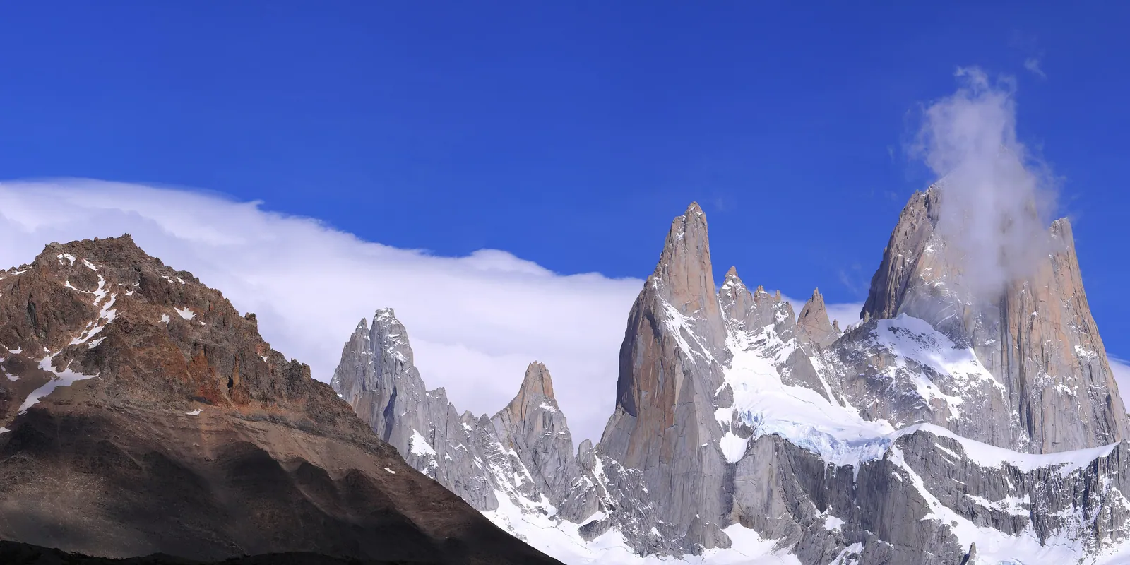
When you watch Perito Moreno calve a slab the size of a building into Lago Argentino, or pick your way across Grey Glacier on crampons, or look up at the distant white plateau above Fitz Roy's peaks, you are seeing fragments of one body. The glaciers are the ice field's extremities, and the ice field is its deep interior. Patagonia's landscape of ice is not a collection of separate landmarks — it is a single, enormous, slowly diminishing thing.
Quick answers
How large is the Southern Patagonian Ice Field?
The Southern Patagonian Ice Field covers approximately 13,000 square kilometres, making it the third-largest reserve of freshwater ice outside the polar regions. Only the Greenland ice cap and the Antarctic ice sheet are larger non-polar ice bodies. It straddles the border of Argentina and Chile along the southern Andes and feeds dozens of outlet glaciers on both sides of the range.
Can you visit the ice field itself, rather than just the glacier tongues?
The interior of the ice field is accessible only with full mountaineering and expedition logistics, and it is extremely remote. Most travellers see it from the glacier termini — Perito Moreno, Grey, Upsala — or from the John Garner Pass on the O Circuit in Torres del Paine, which offers the best open view of the ice field surface available to a walking traveller.
Is the Southern Patagonian Ice Field retreating?
Yes. Research shows that most of the ice field's outlet glaciers have been thinning and retreating since the mid-twentieth century, with the rate accelerating in recent decades. Perito Moreno is the notable exception, remaining close to balance for reasons related to its particular geometry. Upsala Glacier, once accessible by boat, has retreated so significantly that the approach that was routine a generation ago is no longer possible.
Which is the best glacier to visit from the Argentine side?
Perito Moreno, reached from El Calafate, is the most accessible and the most dramatic for close-up viewing — its calving face is five kilometres wide and visible from a network of walkways just metres away. Upsala is larger but more remote, reached by a long boat journey through an iceberg-filled lagoon, and its retreating face cannot be approached as closely as in the past. Both are worth the time.
Let the reading become a route.
When an article sparks something, our planners are the next step. Tell us what you are dreaming of.