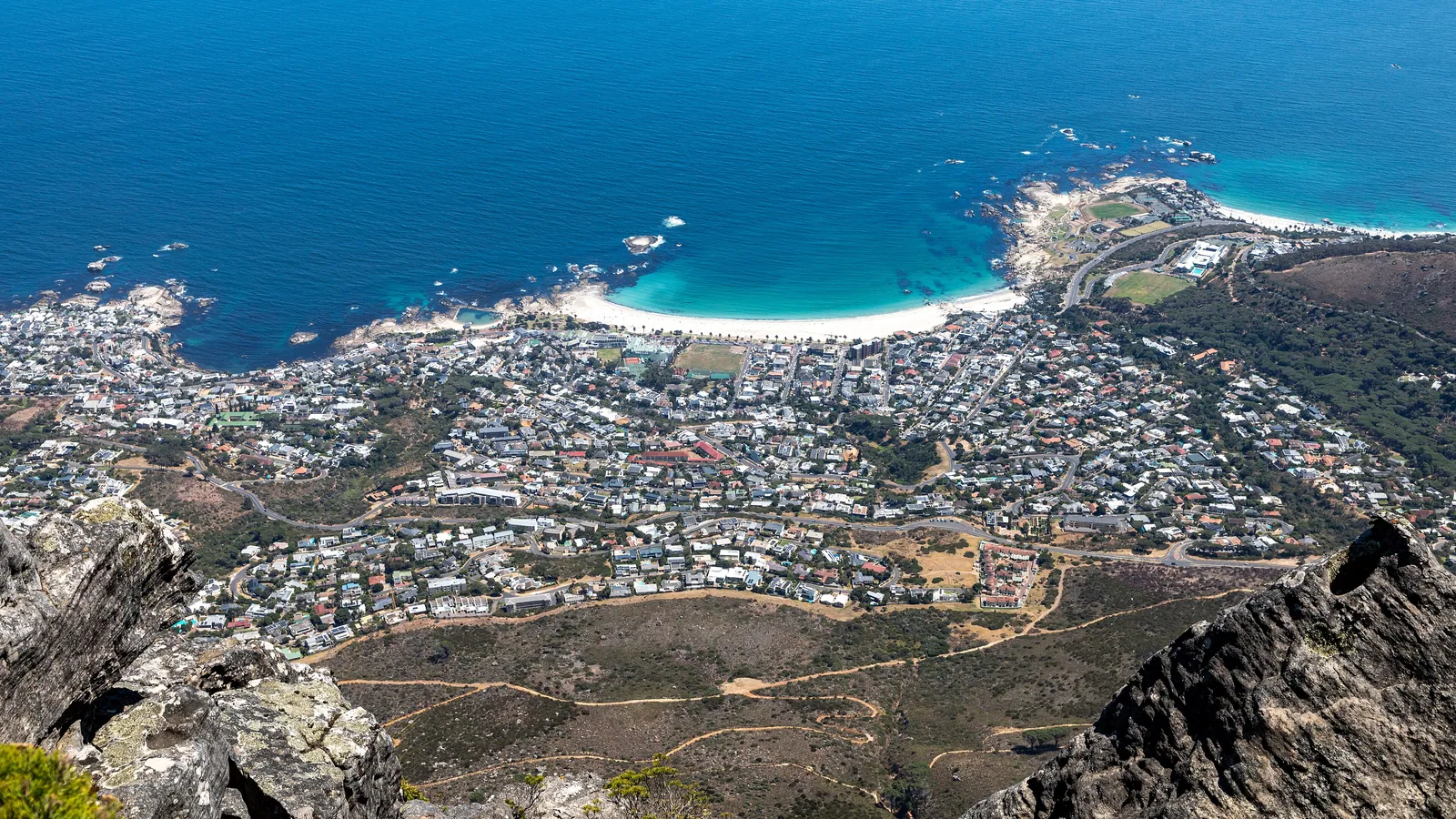
Where Two Oceans Meet: The Cape of Good Hope and Cape Agulhas
Two famous capes mark the southern tip of Africa, and travellers often confuse them. Here is which is which, where the Atlantic and Indian oceans truly meet, and how to read this storied, wind-scoured coast.
The southern end of Africa is marked by two capes that are often muddled. The Cape of Good Hope, on the Cape Peninsula south of Cape Town, is the dramatic, much-visited headland — but it is not the continent's southernmost point. That title belongs to Cape Agulhas, a lower, quieter cape about 150 kilometres to the south-east, and it is there, by the official convention, that the Atlantic and Indian oceans meet.
So the short answer for a confused traveller: the Cape of Good Hope is the spectacular scenery; Cape Agulhas is the true geographic tip and the recognised dividing line between the two oceans. Both are worth visiting, and both tell the same long story — a coast that shaped global trade routes, wrecked countless ships, and still meets the traveller with sheer cliffs, hard wind and an enormous sky.
Two capes, and which is which
The Cape of Good Hope is the rocky promontory at the end of the Cape Peninsula, within Table Mountain National Park. Beside it, Cape Point rises in steep cliffs crowned by lighthouses. It is one of the most photographed headlands in the world, and from its heights the ocean stretches uninterrupted toward Antarctica.
Cape Agulhas, by contrast, is understated — a long, low, rocky shore without towering cliffs. Its name comes from the Portuguese for needles, thought to refer either to jagged offshore rocks or to a historical quirk of compass behaviour in the area. What it lacks in drama it holds in significance: this, not the Cape of Good Hope, is the southernmost point of the African continent.
Where the oceans actually meet
By international convention, the boundary between the Atlantic and Indian oceans runs along the meridian of Cape Agulhas — the line of longitude passing through the cape. By that definition the two oceans meet at Africa's southern tip, and a marker at Cape Agulhas commemorates the spot.
There is no visible seam in the water, of course; ocean boundaries are agreed lines, not physical walls. But the surrounding seas genuinely differ. The Atlantic side, cooled by the Benguela Current, is markedly colder; the Indian Ocean side, warmed in part by the Agulhas Current flowing down the east coast, is warmer. The contrast in water temperature around the Cape is real, even if the boundary itself is a human convention.
A coast of storms and shipwrecks
This is one of the world's great ship-graveyard coasts. The waters off the southern Cape are notorious for the meeting of strong currents, powerful winds and, periodically, freak waves — and for centuries they wrecked vessels on the route between Europe and the East. The Portuguese explorer who first rounded the Cape in 1488 is said to have called it the Cape of Storms; the more hopeful name came later, for the sea route to Asia it opened.
The Agulhas Bank, a broad shallow shelf extending south of the cape, complicates the seas further and is also one of the richest fishing grounds in the region. To stand on either cape in a gale is to understand instantly why this coast earned its fearsome reputation among sailors.
Wildlife at the continent's edge
The capes are alive. The Cape Peninsula shelters a famous colony of African penguins at Boulders Beach, and its fynbos slopes support antelope, baboons and an exceptional diversity of plants. Offshore, the cold productive waters draw seals, dolphins and seabirds, and in season southern right whales pass close to shore.
Cape Agulhas and its surroundings, less visited, are quietly rewarding for birdwatchers and for those who like a coastline without crowds. Both capes sit within or alongside protected areas of the Cape Floral Region, so the land behind the sea is as botanically remarkable as the seascape is dramatic.
The capes as a journey's end
There is something fitting about standing at the southern tip of a continent. For a traveller who has crossed Africa from the deserts of the Namib through the thunder of Victoria Falls and down the green Garden Route, the capes are a natural full stop — the land simply runs out, and two oceans take over.
On The Great Rift journey this southern coast marks the close of the African chapters. Whether you stand on the high cliffs of Cape Point or the low rocks of Cape Agulhas, the sensation is the same: the end of the road, the edge of the map, and a great deal of ocean ahead.
Quick answers
Is the Cape of Good Hope the southernmost point of Africa?
No, this is a common misconception. The Cape of Good Hope is the dramatic headland on the Cape Peninsula south of Cape Town, but the southernmost point of the African continent is Cape Agulhas, about 150 kilometres to the south-east. Cape Agulhas is lower and less spectacular, but it is the true geographic tip.
Where do the Atlantic and Indian oceans meet?
By international convention, the boundary runs along the line of longitude passing through Cape Agulhas, so the two oceans are considered to meet at Africa's southernmost point. There is no visible line in the water — ocean boundaries are agreed conventions — but the Atlantic side is genuinely colder and the Indian Ocean side warmer.
Why is this coast so dangerous for ships?
The southern Cape combines strong ocean currents, powerful winds and occasional freak waves, and the shallow Agulhas Bank further complicates the seas. For centuries these conditions wrecked ships on the trade route between Europe and the East, which is why the early Portuguese name for the area was the Cape of Storms.
Let the reading become a route.
When an article sparks something, our planners are the next step. Tell us what you are dreaming of.