El Chalten and the Trails Below Mount Fitz Roy
Argentina's self-styled trekking capital sits at the foot of Mount Fitz Roy, and its great virtue is simple: the trails begin in the village. You walk out of town toward Patagonia's most famous granite.
El Chalten is a small town in the north of Los Glaciares National Park, in Argentine Patagonia, founded only in 1985 and built almost entirely around walking. It bills itself as the trekking capital of Argentina, and the claim is fair for one practical reason above all: the main trails start from the streets themselves, so you lace your boots at your guesthouse and walk straight onto the mountain.
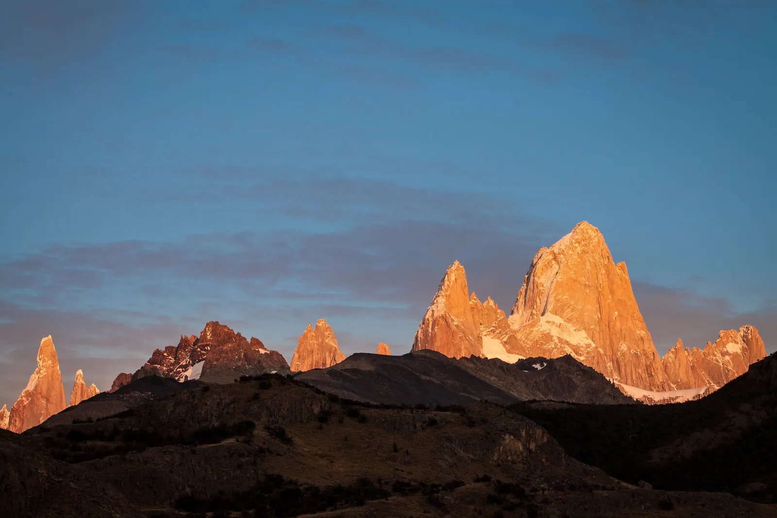
Above the town stands Mount Fitz Roy, a 3,405-metre spire of granite also known by its Tehuelche name, Chalten — the smoking mountain — for the cloud that so often streams from its summit. Around it cluster the needles of Cerro Torre and their neighbours. You do not climb these peaks; they are among the hardest in the world. You walk the valleys beneath them, and that walking is the centrepiece of the El Chalten section of our Andes to Antarctica journey.
A town built for walkers
El Chalten's design is its main attraction. Most Patagonian trailheads require a drive; here the trails are signposted from the edge of the village, the national park charges no entrance fee for the area, and you can structure your days entirely on foot and on the weather.
That freedom rewards a flexible itinerary. Because the big viewpoints are day walks rather than multi-day expeditions, you can wait out a grey, wind-lashed morning over coffee and set off when a clearing arrives — and in this part of Patagonia, clearings can be sudden and brief. Two or three nights in town give you the latitude to catch Fitz Roy on a good day.
The walk to Laguna de los Tres
The signature hike is the route to Laguna de los Tres, the lake set directly beneath the Fitz Roy massif. It is roughly a 20-kilometre round trip from El Chalten, typically eight to ten hours, and moderate for most of its length — until the final kilometre.
That last stretch is a steep, relentless climb of around 400 metres up a rough moraine slope, and it is the hardest part of the day by a wide margin. The reward at the top is one of the defining views of the Andes: the granite towers of Fitz Roy rising sheer above a glacial tarn. Many walkers start before dawn to reach the lake for sunrise, when the rising light can flush the rock a brief, intense red.
Laguna Torre and the shorter trails
The other classic walk leads to Laguna Torre, a glacier-fed lake facing the slender, frequently cloud-wrapped spire of Cerro Torre. It is a gentler outing than Laguna de los Tres — about 18 to 22 kilometres round trip with less steep climbing — and a strong choice on a windier day or for a less punishing pair of legs.
El Chalten also offers shorter options for half-days or rest days: the viewpoints of Mirador de los Condores and Mirador de las Aguilas sit close to town, and the trail to Chorrillo del Salto reaches a pretty waterfall on an easy walk. The range of distances means a group of mixed ability can each find a fitting day and still meet for dinner.
Reading the weather and the wind
Fitz Roy is famous for hiding. The summit is cloud-wrapped far more often than it is clear, and the wind here can be ferocious, particularly on exposed ridges and around the lakes. The town's name — the smoking mountain — is a centuries-old acknowledgement that the peak makes its own weather.
The practical response is patience and preparation. Build spare days into your stay, watch the forecast but trust the sky more, and be ready to move fast when a window opens. Carry a windproof and waterproof shell, warm layers, gloves and a hat in every season, and treat the final moraine climb to Laguna de los Tres as a place to turn back without regret if conditions on top are dangerous.
El Chalten and El Calafate together
El Chalten pairs naturally with El Calafate, about three hours south by road. El Calafate is the base for the Perito Moreno glacier and Lago Argentino; El Chalten is the base for the Fitz Roy and Cerro Torre trails. Between them they cover the two great faces of Los Glaciares National Park — its ice and its granite.
On our journeys the two towns are visited as a pair, which is how the region is best understood: a day among calving glaciers near El Calafate, then several days walking the valleys of El Chalten. It is an unhurried way to meet northern Patagonia, and it leaves the towers themselves to be earned on foot rather than glimpsed from a bus window.
Quick answers
Do I need to climb Mount Fitz Roy to enjoy El Chalten?
Not at all. Mount Fitz Roy and Cerro Torre are extremely difficult technical climbs reserved for elite mountaineers. The experience for travellers is walking the valleys and lakes beneath them — above all the day hike to Laguna de los Tres, set directly under the Fitz Roy massif. The famous views are reached on foot, by ordinary fit walkers, with no climbing involved.
How hard is the hike to Laguna de los Tres?
It is a roughly 20-kilometre round trip from El Chalten, usually eight to ten hours, and moderate for most of its length. The difficulty is concentrated in the final kilometre: a steep, sustained climb of around 400 metres up a rough moraine slope. The rest of the trail is far gentler. Good fitness and comfort with a long day on foot are enough.
Will I actually see Fitz Roy, or is it always in cloud?
Fitz Roy is cloud-wrapped more often than it is clear, and there is no guarantee on any single day. The best strategy is time: stay two or three nights in El Chalten so you can wait out poor weather and walk when a clearing arrives. Because the trails start from the town, you keep the flexibility to move quickly when the mountain shows itself.
Let the reading become a route.
When an article sparks something, our planners are the next step. Tell us what you are dreaming of.