Over the High Atlas to the Edge of the Sahara
South of Marrakech the land rises into the High Atlas and then falls away toward the desert. Here is what lies along that route — the mountain passes, the Berber valleys, the kasbah trails and the dunes beyond.
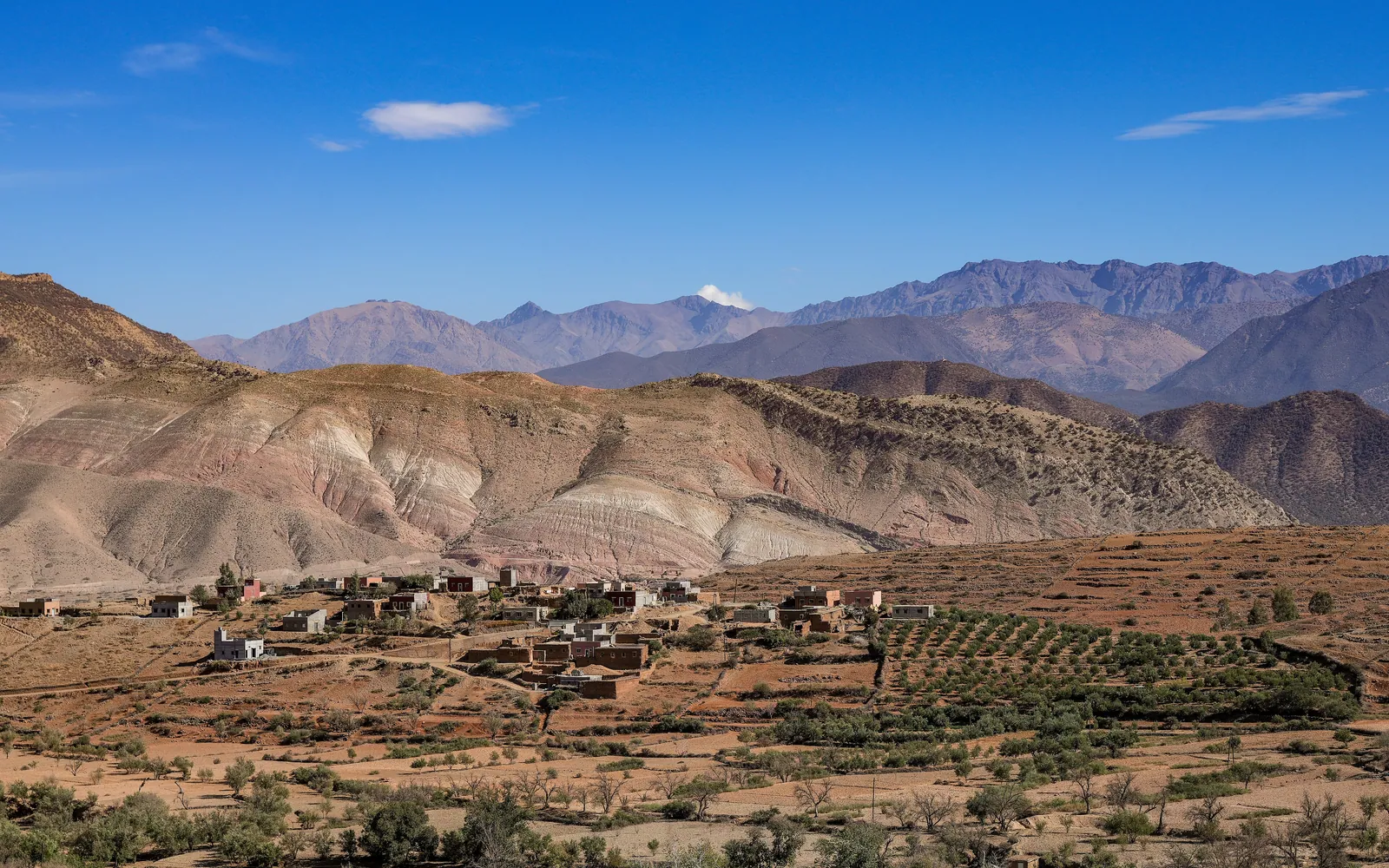
Marrakech stands on a plain, but its southern horizon is a wall of mountains: the High Atlas, the highest range in North Africa, snow-capped for much of the year. Cross it, and the land changes utterly — green valleys give way to oasis palmeries, then to gravel desert, and finally to the great sand seas at the edge of the Sahara.
This journey south of Marrakech is one of the most rewarding excursions in Morocco, but it is genuinely a journey, not a day trip. The distances are real and the road climbs hard. Understanding what lies along the route — the passes, the Berber villages, the fortified kasbahs and the dunes — lets a traveller see it as a passage through several worlds rather than a dash to a photograph.
The High Atlas, the spine of Morocco
The High Atlas runs for roughly seven hundred and fifty kilometres across Morocco, separating the Atlantic plains and Marrakech from the desert south. Its summits exceed four thousand metres — Toubkal, south of Marrakech, is the highest peak in North Africa at over 4,160 metres — and snow lies on the high ground well into spring, which is why the range so often appears as a white backdrop to the city.
These mountains are the homeland of Amazigh, or Berber, communities whose villages of earthen houses cling to the slopes above terraced fields. The High Atlas is also a water tower: the snowmelt and springs of the range feed the rivers and the underground channels that have made Marrakech and its gardens possible. To cross the mountains is to see where the city's life literally begins.
The Tizi n'Tichka pass
The classic route south from Marrakech climbs the Tizi n'Tichka, the principal pass over the High Atlas, reaching some 2,260 metres at its summit. The road switchbacks steeply through changing zones of vegetation and rock, with long views back over the valleys, and roadside stalls selling minerals, fossils and Berber goods at the higher bends.
It is a slow and winding drive, and that is part of its value: the pass is the threshold between two Moroccos. On the northern side the land is greener and tilts toward Marrakech; cross the summit and the country ahead is drier, more austere and tinted red, falling away toward the pre-Saharan basins. Travellers prone to motion sickness should plan for the curves, but the crossing itself is unforgettable.
Kasbahs and the road of a thousand fortresses
On the southern side of the Atlas the architecture changes. The valleys here are lined with kasbahs and ksour — fortified houses and villages built of rammed earth, with tapering towers and decorated upper walls. The most celebrated is Aït Benhaddou, a striking earthen ksar on the old caravan route between the Sahara and Marrakech, and a UNESCO World Heritage site.
The nearby town of Ouarzazate has long been a gateway to the desert and is also a centre of Moroccan film-making, with studios drawn by the dramatic landscapes. Beyond it the Dadès and Todra valleys cut deep gorges into the rock, their floors green with palms and almond trees — oases strung along rivers fed, once again, by Atlas snow.
The dunes at the desert's edge
Continue south and east and the land opens toward the true desert. The Sahara around Marrakech's reach is mostly stony hammada and gravel plain, but in two places it rises into the classic sand seas, or ergs, that most travellers picture. Erg Chebbi, near Merzouga, and Erg Chigaga, beyond M'Hamid, are great fields of wind-shaped dunes, some over a hundred metres high.
Reaching them takes time — these ergs lie a long way south of Marrakech — but the reward is the desert at its most elemental. The dunes are at their finest at dawn and dusk, when low light models every ridge, and the night skies are exceptionally clear. Camps among or beside the dunes allow travellers to experience the silence and the stars, with camel treks the traditional way to move on the sand.
The southern route on The Long Way East
On The Long Way East — the journey from Madrid that crosses from Spain into Morocco — Marrakech is a base from which the country's interior opens up. The route south over the High Atlas is taken as an unhurried passage: the mountain pass, a Berber valley, the kasbahs and, for those continuing, the dunes are given the days they deserve.
This matters because the desert and the mountains are not a detour from the journey but a deepening of it. The Long Way East is built on slow, overland travel, and the country south of Marrakech — rising into the snow of the Atlas and falling to the sand of the Sahara — is North Africa shown in full, the natural close to the Moroccan chapter before the journey turns onward.
Quick answers
Can you visit the Sahara on a day trip from Marrakech?
Not the great sand dunes. The classic ergs — Erg Chebbi near Merzouga and Erg Chigaga beyond M'Hamid — lie a long way south and east of Marrakech, well beyond a comfortable day's return. Reaching them properly takes at least a couple of days each way. A day trip from Marrakech can reach the High Atlas and its foothill valleys, but the true desert needs a longer journey.
How high is the Tizi n'Tichka pass, and is the road difficult?
The Tizi n'Tichka reaches roughly 2,260 metres at its summit, making it the main pass over the High Atlas on the route south from Marrakech. The road is paved but steep and full of switchbacks, so the drive is slow and winding. Travellers prone to motion sickness should prepare for the curves, but the crossing is straightforward and the scenery is exceptional.
What is a kasbah?
In southern Morocco, a kasbah is a fortified house or small castle built of rammed earth, typically with tapering corner towers and decorated upper walls. Several kasbahs or fortified family compounds together form a ksar, a fortified village. The earthen ksar of Aït Benhaddou, on the old caravan route between the Sahara and Marrakech, is the best-known example and a UNESCO World Heritage site.
Let the reading become a route.
When an article sparks something, our planners are the next step. Tell us what you are dreaming of.